Market Overview
The Asia Pacific remote sensing technology market is experiencing significant growth driven by the increasing demand for satellite and aerial imagery for various applications such as environmental monitoring, agriculture, defense, and urban planning. Remote sensing technology involves the acquisition of information about an object or phenomenon without making physical contact, primarily through the use of satellites, aircraft, and drones equipped with sensors. The region’s diverse geography, ranging from densely populated urban areas to vast rural landscapes, makes it an ideal market for remote sensing applications. The growing emphasis on sustainable development, coupled with advancements in sensor technology, is further propelling the market. Governments and private organizations are increasingly leveraging remote sensing technology for data-driven decision-making, enhancing the efficiency and effectiveness of operations across various sectors. Moreover, the integration of artificial intelligence (AI) and machine learning (ML) algorithms in remote sensing data analysis is unlocking new opportunities for growth and innovation in the market.
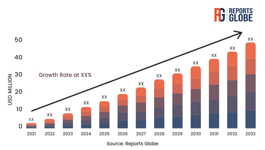
Key Takeaways of the Market
- Rising Demand: Increasing need for satellite and aerial imagery across various sectors such as agriculture, defense, and urban planning.
- Technological Advancements: Integration of AI and ML in remote sensing data analysis.
- Government Initiatives: Supportive policies and investments by governments to promote the use of remote sensing technology.
- Environmental Monitoring: Growing emphasis on environmental sustainability and climate change monitoring.
- Commercial Applications: Expanding use of remote sensing in commercial sectors like real estate and insurance.
- Defense Applications: Significant investments in remote sensing technology for defense and security purposes.
- Data Analytics: Enhanced capabilities in data processing and analytics driving market growth.
- Cost Reduction: Decreasing costs of satellite launches and sensor technology.
Market Driver
One of the primary drivers of the Asia Pacific remote sensing technology market is the increasing emphasis on environmental monitoring and sustainable development. The region faces significant environmental challenges, including deforestation, water scarcity, air pollution, and climate change. Remote sensing technology provides a powerful tool for monitoring and managing these environmental issues. Satellite imagery and aerial data can offer real-time insights into land use changes, forest cover, water bodies, and urbanization patterns, enabling governments and organizations to make informed decisions. For instance, remote sensing data can help in tracking deforestation activities, assessing the health of agricultural lands, monitoring water resources, and predicting natural disasters such as floods and droughts. Additionally, the adoption of remote sensing technology for environmental applications is being driven by international commitments to climate change mitigation and sustainable development goals (SDGs). The ability to gather accurate and timely data through remote sensing is crucial for implementing effective environmental policies and strategies. Furthermore, advancements in sensor technology, including high-resolution and hyperspectral imaging, are enhancing the capabilities of remote sensing systems, making them more reliable and effective for environmental monitoring.
Market Restraint
Despite the promising growth prospects, the Asia Pacific remote sensing technology market faces several challenges that could restrain its growth. One significant challenge is the high cost associated with the deployment and maintenance of remote sensing infrastructure. Satellite launches, sensor development, and data processing require substantial investments, which can be a barrier, especially for smaller organizations and developing countries. Additionally, the complexity of remote sensing technology and the need for skilled personnel to operate and interpret the data can limit its adoption. There is also a lack of standardized protocols and interoperability among different remote sensing systems, which can hinder seamless data integration and sharing across various platforms. Data security and privacy concerns also pose significant challenges, as remote sensing involves the collection and transmission of large volumes of sensitive information. Ensuring the protection of this data and compliance with regulatory requirements is critical to maintaining trust in remote sensing technology. Moreover, the availability and accessibility of high-resolution satellite imagery can be limited due to regulatory restrictions and commercial licensing issues, which can affect the timely acquisition of data for certain applications.
Market Opportunity
The Asia Pacific remote sensing technology market presents significant growth opportunities, driven by the increasing adoption of remote sensing for precision agriculture and smart city development. Precision agriculture, which involves the use of remote sensing technology to optimize crop management, is gaining traction in the region. Farmers and agricultural organizations are leveraging satellite and aerial imagery to monitor crop health, soil conditions, and irrigation needs, enabling data-driven decisions that enhance productivity and sustainability. The integration of remote sensing data with other technologies such as GPS and IoT sensors is further enhancing the capabilities of precision agriculture. This trend is particularly significant in countries like India and China, where agriculture plays a crucial role in the economy and food security.
Smart city initiatives across the Asia Pacific region also offer substantial opportunities for the remote sensing technology market. Governments are increasingly focusing on developing smart cities to address the challenges of urbanization, including infrastructure management, traffic congestion, and environmental sustainability. Remote sensing technology provides critical data for urban planning, infrastructure monitoring, and disaster management, making it an essential component of smart city projects. The deployment of high-resolution satellite imagery and aerial data in smart city applications can improve the efficiency of urban services, enhance public safety, and promote sustainable development. Collaborations between technology companies, government agencies, and urban planners are driving the integration of remote sensing technology into smart city frameworks, creating new avenues for market growth.
Market Segment Analysis
By Platform: Satellite-based Remote Sensing
Satellite-based remote sensing is a dominant segment in the Asia Pacific remote sensing technology market, driven by its extensive applications and wide coverage capabilities. Satellites equipped with advanced sensors provide continuous and comprehensive monitoring of the Earth’s surface, offering valuable data for various applications such as environmental monitoring, disaster management, agriculture, and defense. The increasing number of satellite launches and the development of high-resolution and hyperspectral imaging technologies are enhancing the capabilities of satellite-based remote sensing. Governments and private organizations in the region are investing heavily in satellite infrastructure to support national and regional remote sensing programs. The data acquired from satellites is used for mapping land use changes, monitoring natural resources, assessing the impact of climate change, and supporting military operations. The growing availability of commercial satellite imagery and the decreasing cost of satellite launches are further driving the adoption of satellite-based remote sensing in the Asia Pacific region.
By Application: Agricultural Monitoring
Agricultural monitoring is a significant application segment in the Asia Pacific remote sensing technology market, driven by the need to enhance agricultural productivity and sustainability. Remote sensing technology provides critical data for precision agriculture, enabling farmers to monitor crop health, soil conditions, and irrigation needs in real-time. The use of satellite and aerial imagery allows for the early detection of crop diseases, pest infestations, and nutrient deficiencies, enabling timely interventions that can improve crop yields and reduce losses. Additionally, remote sensing data helps in optimizing the use of inputs such as water, fertilizers, and pesticides, promoting sustainable farming practices. The integration of remote sensing technology with other agricultural technologies such as GPS and IoT sensors is further enhancing the capabilities of precision agriculture. In countries like India and China, where agriculture plays a vital role in the economy and food security, the adoption of remote sensing technology for agricultural monitoring is gaining momentum. Government initiatives and funding support for the development of smart agriculture solutions are also driving the growth of this segment in the region.
Regional Analysis
The Asia Pacific remote sensing technology market is characterized by diverse regional dynamics, influenced by economic, geographic, and technological factors. China is a leading market in the region, driven by significant investments in satellite infrastructure and advancements in remote sensing technology. The Chinese government has implemented several initiatives to promote the use of remote sensing for environmental monitoring, disaster management, and defense applications. China’s ambitious space program, which includes the development and launch of high-resolution satellites, is enhancing the country’s capabilities in remote sensing and driving market growth.
India is another significant market for remote sensing technology, driven by its large and diverse geography, growing agricultural sector, and increasing focus on sustainable development. The Indian Space Research Organisation (ISRO) has been at the forefront of developing and deploying satellite-based remote sensing technology for various applications. The country’s agricultural monitoring programs, disaster management initiatives, and environmental conservation efforts are heavily reliant on remote sensing data. Additionally, the increasing adoption of precision agriculture and smart city projects is driving the demand for remote sensing technology in India.
Japan and South Korea are also key markets for remote sensing technology in the Asia Pacific region. These countries have advanced technological infrastructure and significant investments in space programs and remote sensing applications. Japan’s remote sensing capabilities are driven by its focus on disaster management, environmental monitoring, and defense. The country has developed several high-resolution satellites and aerial sensors to support its remote sensing initiatives. South Korea, with its emphasis on smart city development and technological innovation, is leveraging remote sensing technology for urban planning, infrastructure management, and environmental monitoring.
Other countries in the Asia Pacific region, such as Australia, Singapore, and Malaysia, are also contributing to the growth of the remote sensing technology market. Australia’s vast geography and environmental challenges make it an important market for remote sensing applications in agriculture, forestry, and disaster management. Singapore’s smart city initiatives and emphasis on technological innovation are driving the adoption of remote sensing technology for urban planning and infrastructure monitoring. Malaysia’s focus on sustainable development and environmental conservation is also promoting the use of remote sensing technology in the country.
Competitive Analysis
The Asia Pacific remote sensing technology market is highly competitive, with a mix of global and regional players vying for market share. Leading global companies such as Airbus Defence and Space, Lockheed Martin, and Northrop Grumman dominate the market, offering a wide range of remote sensing solutions, including satellites, sensors, and data analytics services. These companies leverage their strong research and development capabilities, extensive distribution networks, and brand recognition to maintain their competitive edge. Continuous innovation and the introduction of new products with advanced features and improved accuracy are key strategies employed by these players to stay ahead in the market.
Regional players, on the other hand, focus on providing cost-effective solutions tailored to local market needs. Companies such as China Aerospace Science and Technology Corporation (CASC), Indian Space Research Organisation (ISRO), and Japan Aerospace Exploration Agency (JAXA) have a strong presence in the Asia Pacific market, offering competitive remote sensing solutions and services. These companies leverage their understanding of regional market dynamics, government support, and strategic partnerships to enhance their market position. Additionally, collaborations between regional players and global companies are becoming increasingly common, allowing for the sharing of expertise, technology, and resources to address complex remote sensing challenges.
The competitive landscape is also characterized by a growing number of startups and small to medium-sized enterprises (SMEs) that are driving innovation in the remote sensing technology market. These companies focus on niche applications and advanced technologies such as AI, ML, and IoT to offer differentiated solutions. The increasing availability of venture capital funding and government support for innovation is fostering the growth of these startups, contributing to the overall dynamism of the market.
Key Industry Developments
- Product Launches: Introduction of next-generation satellites and sensors with enhanced capabilities and higher resolution.
- Technological Innovations: Development of AI and ML algorithms for advanced data processing and analysis.
- Strategic Partnerships: Collaborations between global and regional players to expand market reach and capabilities.
- Government Initiatives: Implementation of policies and funding support to promote the use of remote sensing technology.
- Environmental Monitoring Programs: Launch of new initiatives for climate change monitoring and environmental conservation.
- Disaster Management Applications: Deployment of remote sensing technology for early warning systems and disaster response.
- Smart City Projects: Integration of remote sensing data in smart city frameworks for urban planning and infrastructure management.
- Agricultural Monitoring Solutions: Development of precision agriculture solutions leveraging remote sensing technology.
Future Outlook
The future outlook for the Asia Pacific remote sensing technology market is highly promising, with continued growth expected over the next decade. The increasing demand for satellite and aerial imagery across various sectors, coupled with advancements in sensor technology and data analytics, will drive market expansion. The integration of AI, ML, and IoT in remote sensing applications will unlock new opportunities for innovation and growth, enabling more accurate and timely data analysis and decision-making.
Government initiatives and supportive policies aimed at promoting the use of remote sensing technology for environmental monitoring, disaster management, and sustainable development will further boost market growth. The increasing adoption of precision agriculture and smart city projects in the region will create significant demand for remote sensing solutions, enhancing the efficiency and effectiveness of operations in these sectors.
Addressing challenges such as high costs, data security concerns, and the need for standardized protocols will be crucial for sustained market expansion. Efforts to reduce the costs of satellite launches and sensor technology, along with advancements in data encryption and privacy measures, will help overcome these challenges and promote wider adoption of remote sensing technology.
Overall, the Asia Pacific remote sensing technology market is poised for significant growth, driven by favorable demographic trends, technological advancements, and increasing investments in infrastructure and innovation. The market’s potential for enhancing data-driven decision-making and promoting sustainable development will continue to attract investments and drive technological advancements in the coming years.
Market Segmentation
- By Platform:
- Satellite-based Remote Sensing
- Aerial-based Remote Sensing (Aircraft, Drones)
- By Sensor Type:
- Optical Sensors
- Radar Sensors
- Thermal Sensors
- LiDAR Sensors
- By Application:
- Environmental Monitoring
- Agricultural Monitoring
- Disaster Management
- Defense and Security
- Urban Planning
- Forestry Management
- Others
- By End-User:
- Government and Public Sector
- Commercial Sector (Agriculture, Real Estate, Insurance, etc.)
- Defense and Security
- Research and Academia
- Others
- By Geography:
- China
- India
- Japan
- South Korea
- Australia
- Southeast Asia (Indonesia, Malaysia, Singapore, Thailand, etc.)
- Rest of Asia Pacific

